PhotoCad Methodology, project insights
Advantages of the PhotoCad methodology
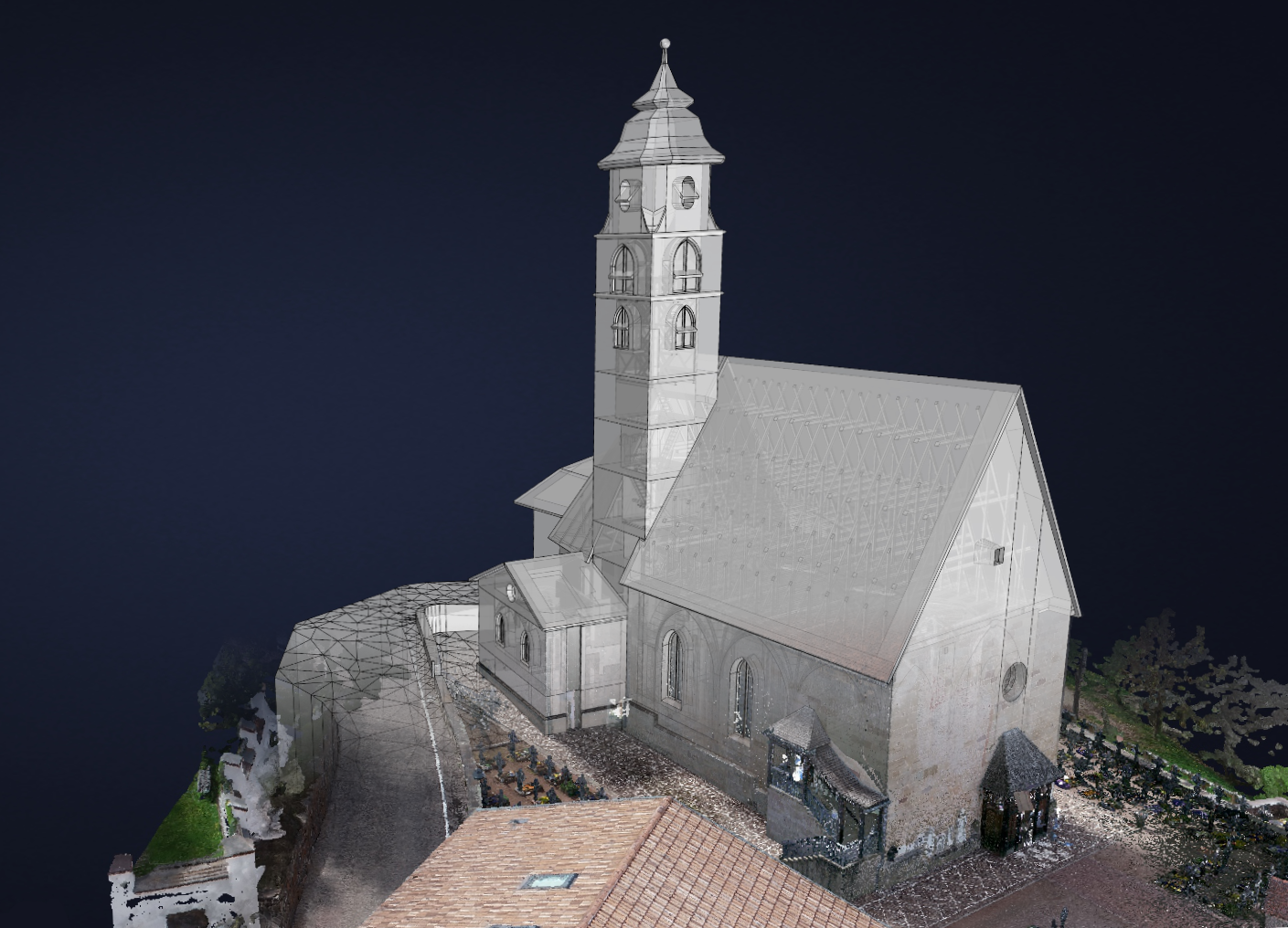
For some time now, PhotoCad has offered an alternative to conventional surveying. In contrast to conventional surveying, the methodology is based on the principle of photogrammetry.
High-resolution point clouds are created using photo and video material. The use of laser scanners for indoor areas and drones for outdoor areas have proven particularly successful.
After the point cloud has been created, it can be viewed in our viewer and various information, such as areas and volumes, can be collected. However, since further planning is based on vector drawings (such as CAD), the point cloud must be abstracted or vectorised.
A major advantage of this method is that the objects to be measured can be surveyed with a precision that is very difficult to achieve with the conventional method. A good example of this is the ribbed vault of the church in Deutschnofen, South Tyrol.
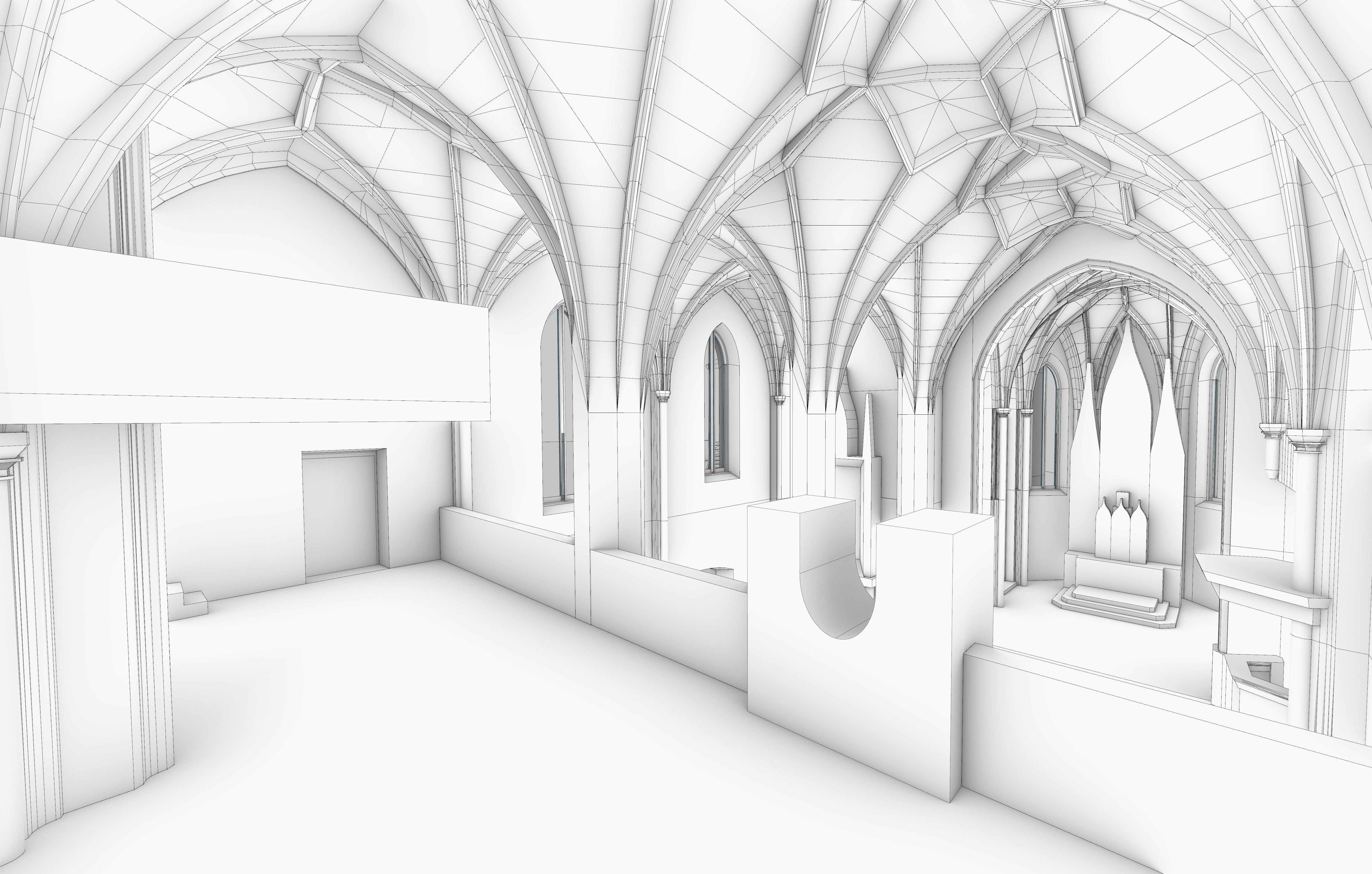
As with most listed buildings, many architectural elements, such as vaults, columns, but also walls, are slightly crooked. These imperfections are difficult to capture with conventional surveying, but are revealed with our approach.
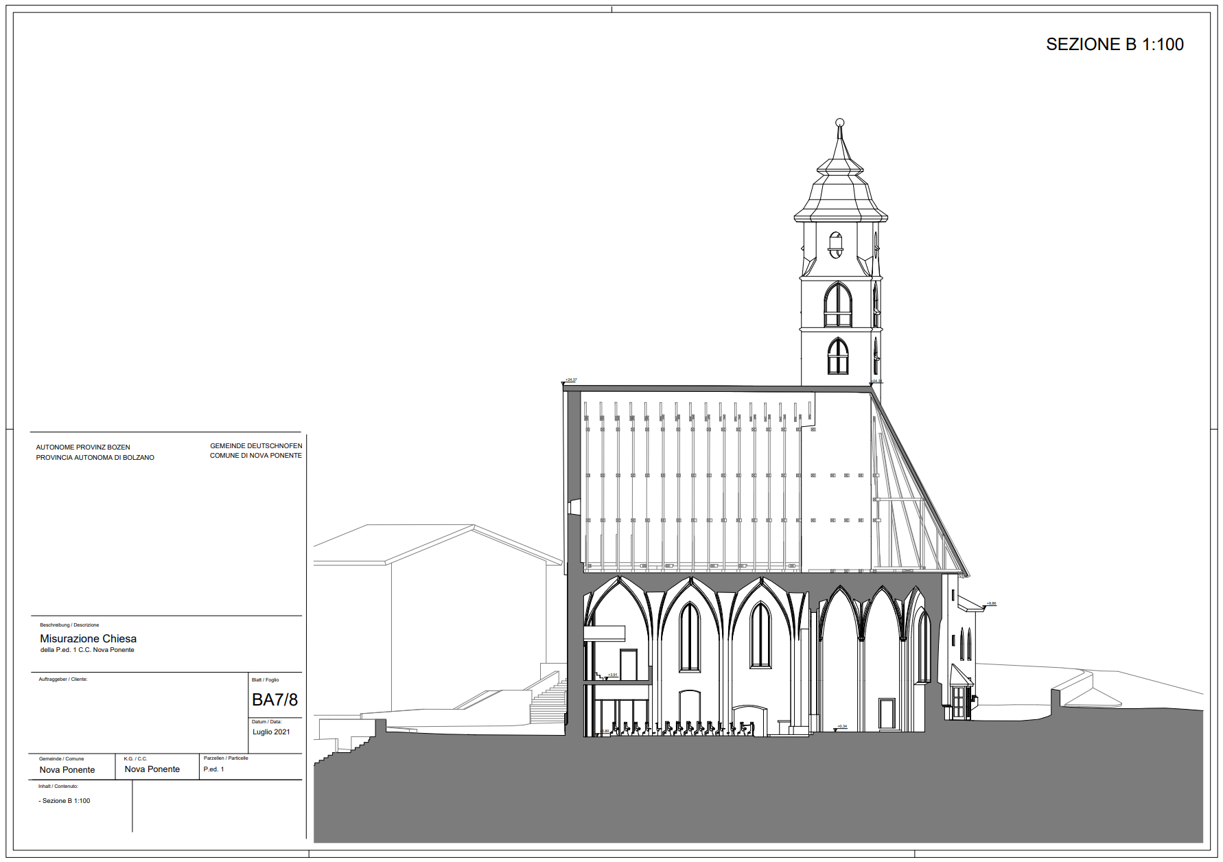
Once the model has been 3D vectorised, it can be exported 3D as a CAD/BIM model or 2D as CAD and PDF for conventional planning.
Another advantage of this process is that further plan representations, such as sections and elevations, do not have to be redesigned, thus saving time and costs. This methodology opens up a previously impossible level of precision and offers great potential in the inventory and renovation of such buildings.
Author: